

This weekend promises a wild ride for the Central U.S. as a slow-moving upper-level pattern sets the stage for various weather events.
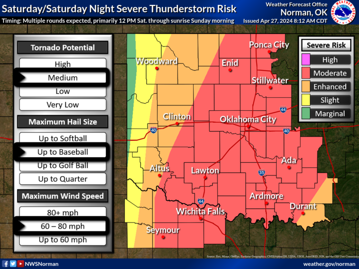
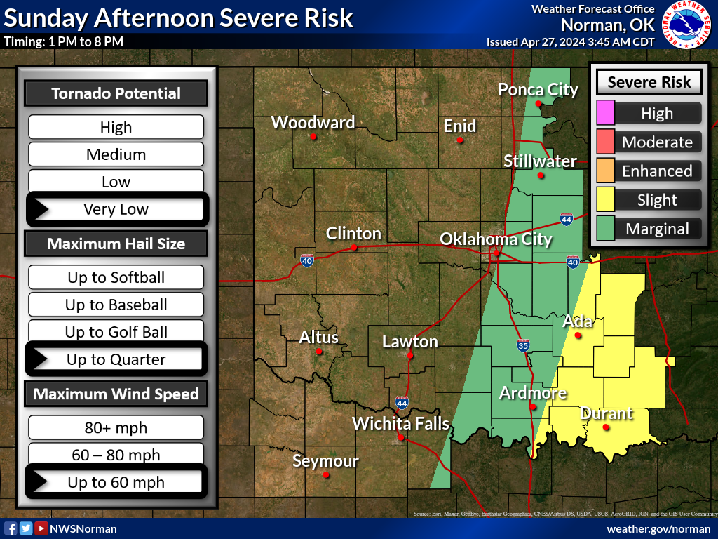
Severe thunderstorms are expected along a cold front stretching across the Southern Plains, bringing risks of large hail, damaging winds, and tornadoes. Damaging wind gusts, large to very large hail and tornadoes are all possible today, with multiple rounds of storms expected. The primary time of severe weather potential would be from Noon through the overnight hours until sunrise Sunday morning.
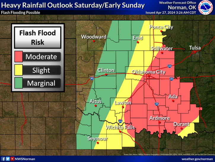
Flash flooding is also a concern due to intense rainfall rates, particularly in parts of the Central and Southern Plains. Meanwhile, the Southern High Plains face critical fire weather conditions, with gusty winds and low dew points creating a high risk of fires.
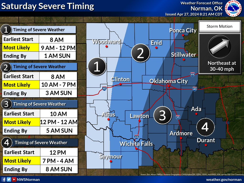
Afternoon/evening severe weather is possible across eastern/southeastern Oklahoma on Friday, with a secondary round of severe weather developing towards daybreak Saturday across western- north Texas.
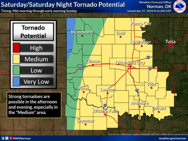
Strong tornados are possible well into the evenings in heavy population centers including Oklahoma City and Wichita Falls.
On Sunday, the focus shifts to the Mississippi Valley, where severe thunderstorms could bring more damaging winds, hail, and tornadoes from east Texas to the Upper Mississippi Valley. This adds to the risk of flash flooding, especially in the Ark-La-Tex region. The Southern High Plains continue to face critical fire weather conditions, exacerbating the challenges in those areas.
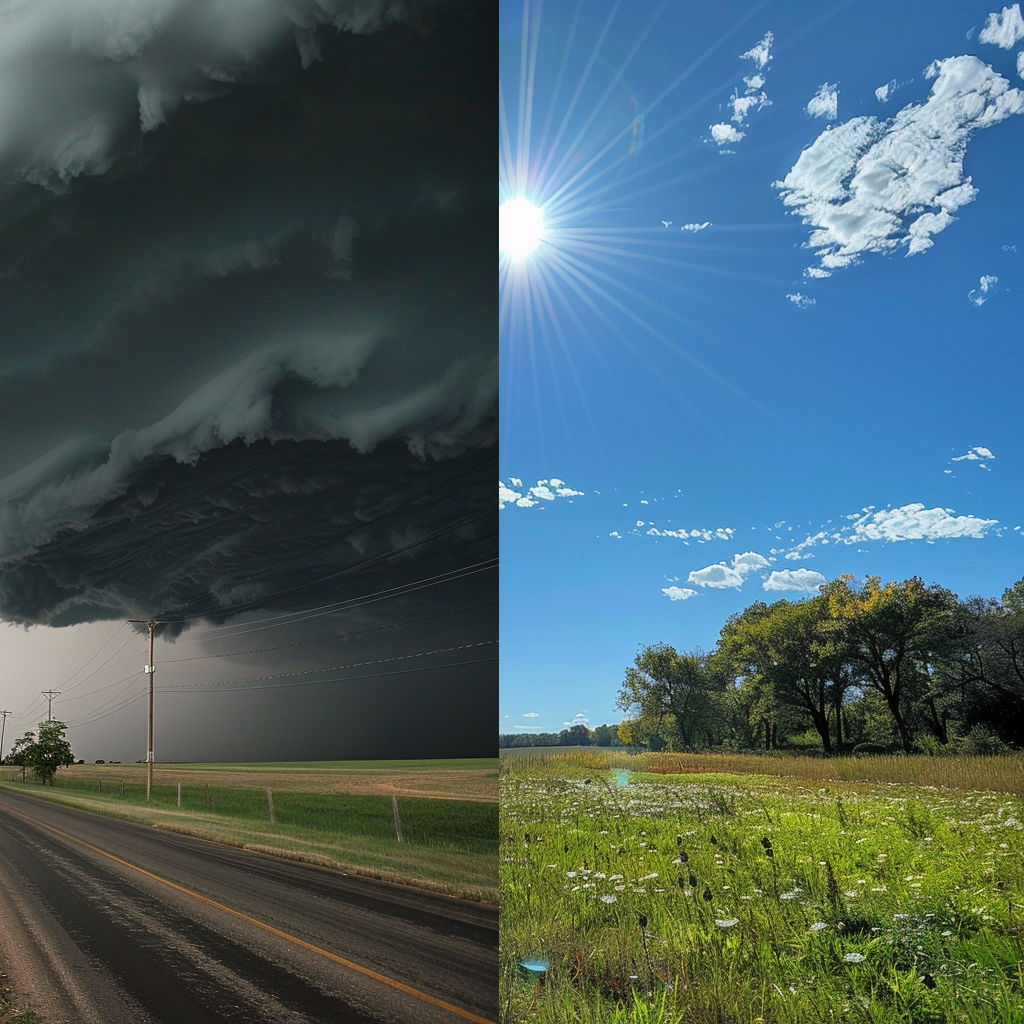
Overall, it’s a weekend of contrasts, with some areas experiencing severe weather and flood risks, while others enjoy warmer temperatures. The dynamic nature of weather systems underscores the importance of staying informed and prepared for changing conditions.
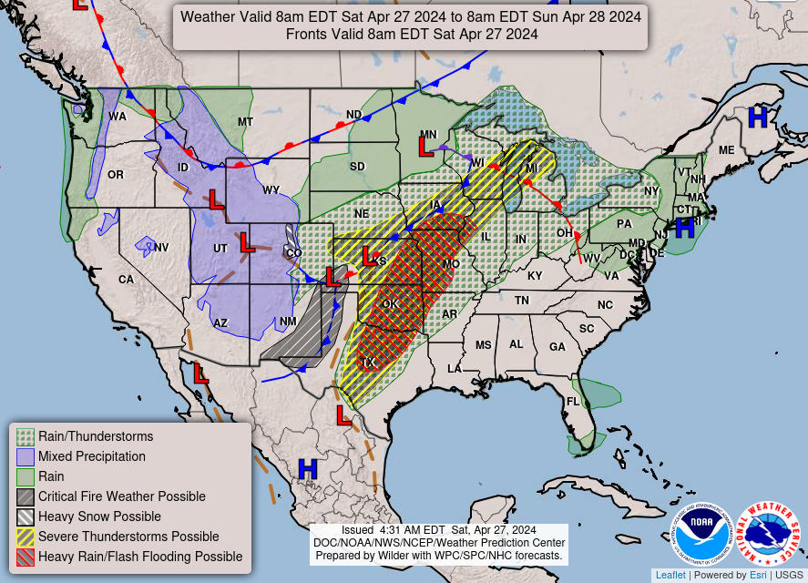
As the upper-level trough moves through, cooler air sweeps into the Rockies, resulting in heavy snowfall in parts of Colorado. Meanwhile, strong southerly flow brings warmer temperatures to the Mississippi Valley and Midwest, with highs reaching the 70s and 80s in some places. However, the Mid-Atlantic may experience cool and cloudy conditions initially before warming up on Sunday.