
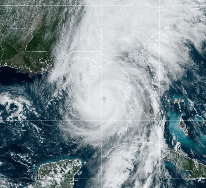
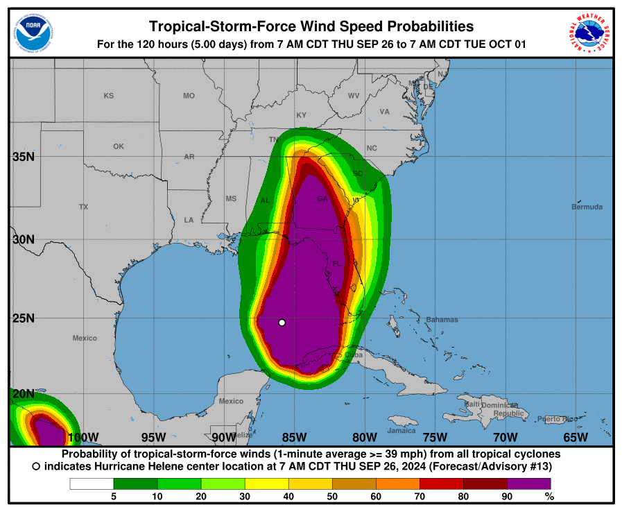
Miami, FL — The National Hurricane Center (NHC) has issued an urgent update on Hurricane Helene, which is rapidly intensifying as it approaches landfall near Florida’s Big Bend region. The hurricane, now packing maximum sustained winds of 110 knots (126 mph), has evolved into a large and powerful storm that could reach Category 4 strength before it makes landfall this evening.
According to the latest advisory from the NHC, Helene has seen significant intensification throughout the day. The storm’s eyewall has become completely closed, and the eye itself has cleared and become more circular, indicative of a rapidly strengthening system. The minimum central pressure has dropped to around 951 mb, a sign of the hurricane’s increased power. Tropical-storm-force winds have already begun affecting parts of west-central and southwestern Florida, with conditions expected to deteriorate rapidly in the next several hours across the Florida Big Bend region.
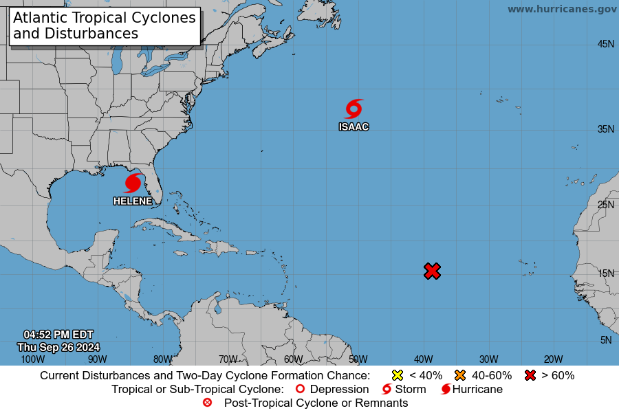
Helene is accelerating north-northeastward at 25 mph and is projected to make landfall later this evening. After landfall, the storm is expected to move over Georgia and then stall over the Tennessee Valley by Friday and Saturday, as it merges with a mid- to upper-level low. The NHC warns that Helene’s fast forward speed will allow its strong winds to penetrate far inland, bringing dangerous gusts as far as the southern Appalachian Mountains.
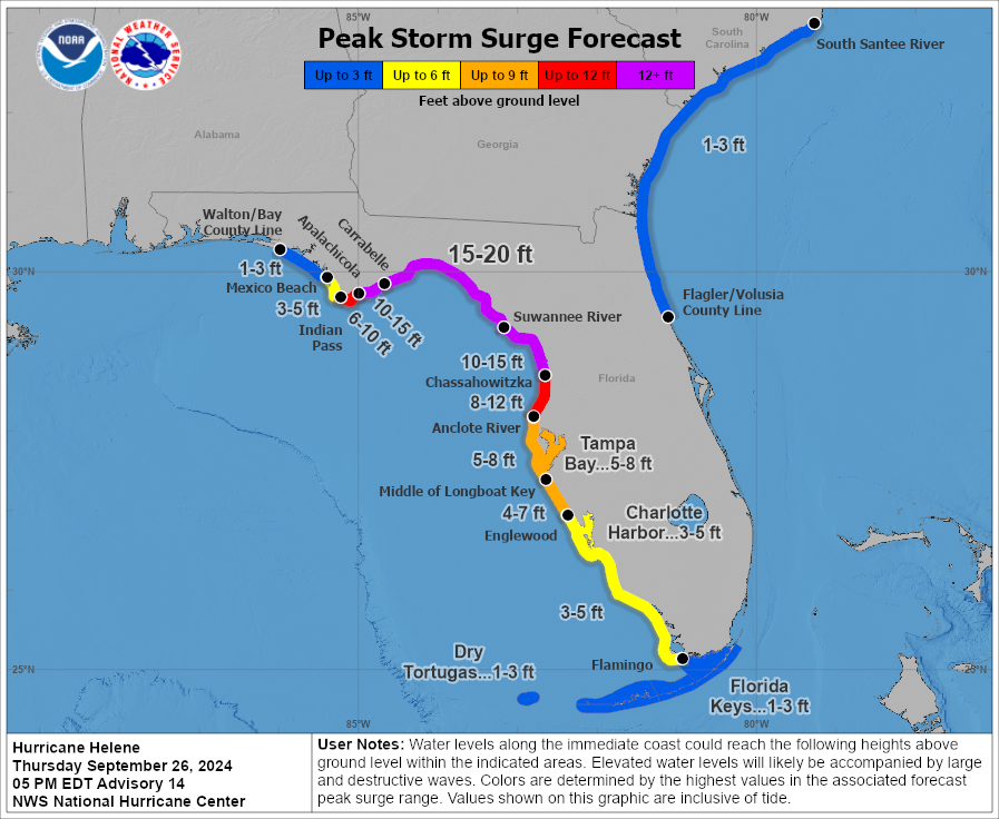
Helene is expected to produce a catastrophic and potentially deadly storm surge along portions of the Florida Big Bend coast. Water levels could rise as high as 20 feet above ground, accompanied by destructive waves. Residents in mandatory evacuation zones are being urged to leave immediately, as the window to escape is rapidly closing.
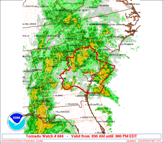
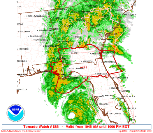
Catastrophic winds are anticipated in the hurricane’s eyewall, with the most severe impacts expected across northern Florida and southern Georgia as the storm makes landfall. Residents in the path of the storm should seek shelter in the interior portion of well-built structures and be prepared to remain sheltered for an extended period due to anticipated downed trees, power lines, and significant flooding.
Damaging wind gusts are expected to extend well inland, impacting portions of Georgia and the Carolinas, especially in elevated areas such as the southern Appalachians. Extended power outages are likely in these regions, and residents are advised to prepare for long-duration blackouts. Generators should be used with caution and placed outside, at least 20 feet away from buildings, to prevent carbon monoxide poisoning.
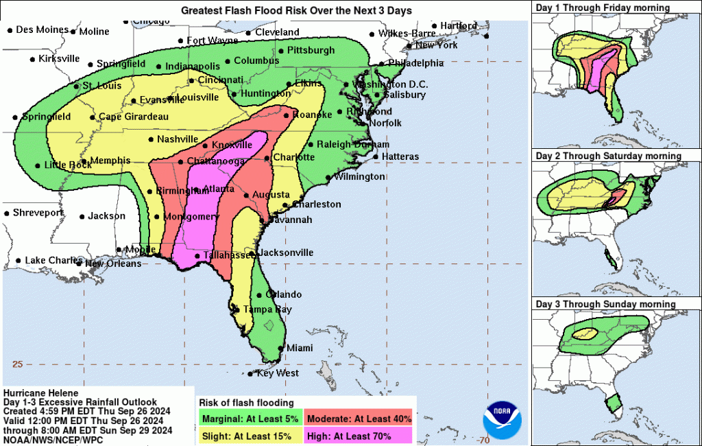
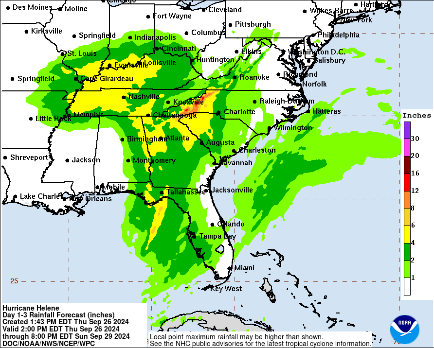
Helene is forecast to bring life-threatening flash floods and urban flooding, particularly in the southern Appalachian region through Friday. Areas of northwestern Florida and the Southeast should also brace for widespread significant river flooding, with isolated major river flooding possible. Landslides are a growing concern in mountainous areas, compounding the threat to residents.
With Helene poised to become one of the most destructive storms of the 2024 Atlantic hurricane season, officials are urging residents in evacuation zones to heed warnings immediately. The storm surge, high winds, and heavy rainfall are expected to create an extremely dangerous situation for those who remain in affected areas. The National Hurricane Center stresses that the time for preparation is running out, and all necessary precautions should be taken to safeguard lives and property. As the storm approaches, federal, state, and local authorities are coordinating response efforts in anticipation of widespread damage. Residents should plan for long germ power outages and should evacuate if in the path of the storm.