
Hazardous Weather Outlook
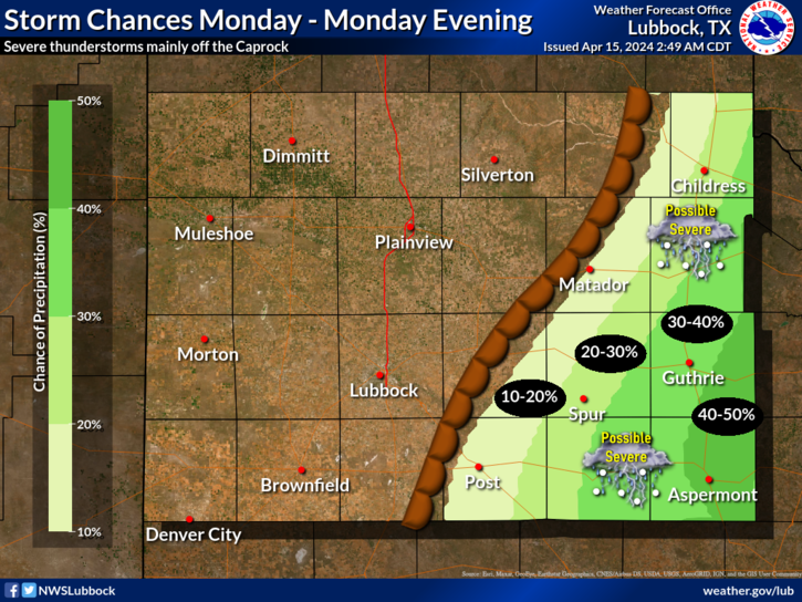
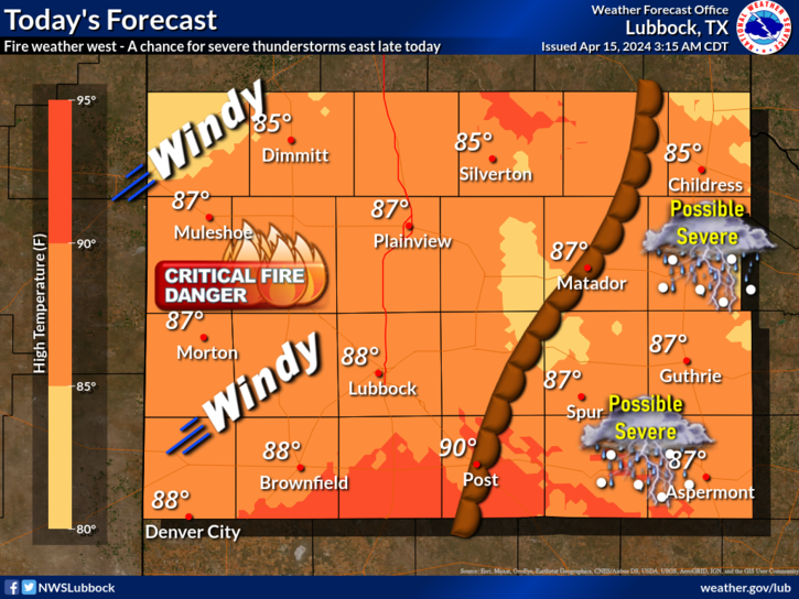
The National Weather Service in Lubbock, TX, has issued a Hazardous Weather Outlook for several counties in the South Plains region. A dryline is forecasted to advance eastward across the area, extending from near Memphis to Lake Alan Henry by late afternoon.
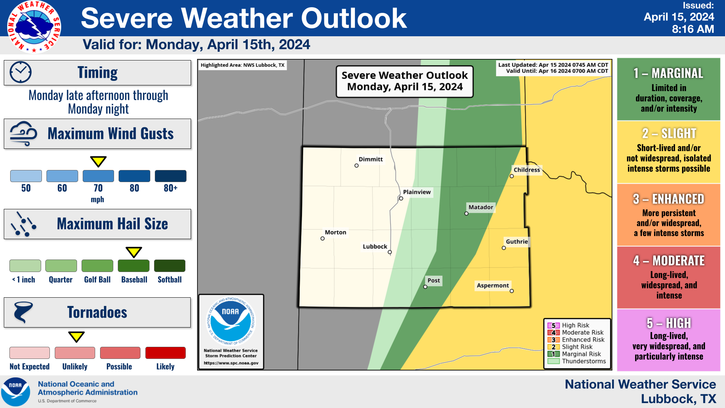
While there is a possibility of thunderstorm development along this dryline, a strong capping inversion to the east may inhibit widespread activity. However, if thunderstorms do develop, they have the potential to become supercells, particularly across the Rolling Plains and far southeastern Panhandle.
Threats: The primary threats associated with these potential supercells include large hail up to the size of baseballs and damaging wind gusts reaching speeds of 70 mph.
This severe weather threat is expected to be most significant between 4 PM and 10 PM.
Residents in the affected areas are advised to stay updated on weather conditions throughout the day and to remain vigilant, especially during the late afternoon and evening hours.
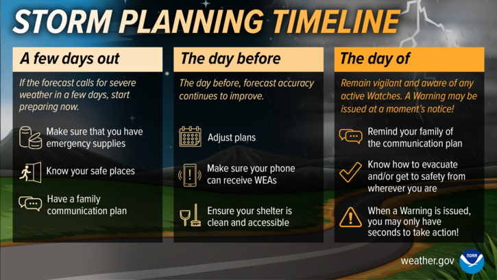
Be prepared to take necessary precautions in the event of severe weather warnings.
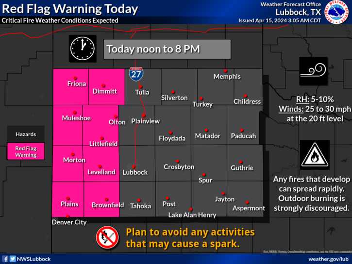
To the west of the dryline very dry air and gusty west to southwest winds will combine with dry fuels to produce elevated to critical fire weather conditions.
Stay tuned to local weather updates and heed any advisories or warnings issued by authorities to ensure your safety during this hazardous weather event.

A Red Flag Warning has been issued for the western South Plains and far southwestern Panhandle from noon to 8 PM. A Fire Danger Statement has been posted for the Interstate 27 corridor.