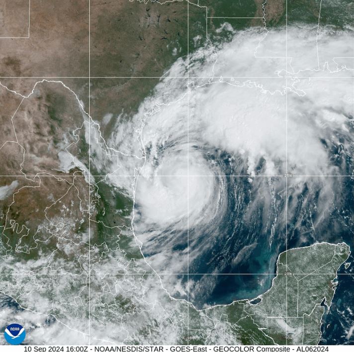
As Tropical Storm Francine strengthens and heads toward the Louisiana coast, concerns about potential levee failures are mounting. The storm is forecast to become a hurricane as it approaches, bringing with it the threat of dangerous storm surges, flash flooding, and significant rainfall across Louisiana and Mississippi. Set to make landfall on September 11, 2024, Francine is a reminder of the ongoing vulnerabilities the region faces, despite improvements made since Hurricane Katrina in 2005.
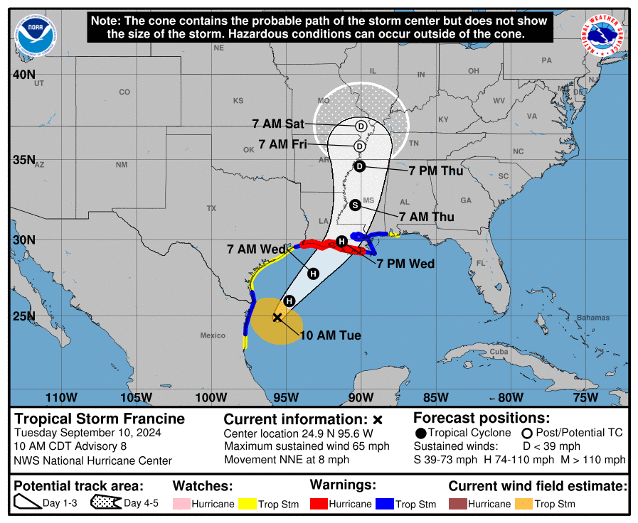
As of 10:00 AM CDT on Tuesday, September 10, 2024, the center of Francine was located near 24.9°N, 95.6°W, moving north-northeast at 8 mph. The storm had a minimum central pressure of 988 mb, with maximum sustained winds of around 65 mph, just below hurricane strength. Francine is expected to strengthen into a hurricane later today as it moves toward the coast of Louisiana.
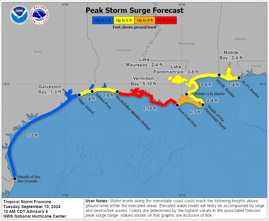
The National Hurricane Center has extended hurricane warnings along the Louisiana coast, with tropical storm warnings in place for parts of southern Texas and northeastern Mexico. Francine’s slow movement is expected to bring prolonged periods of rainfall, raising concerns for flash flooding. Areas already prone to flooding are at higher risk due to the storm’s storm surge projections, with the possibility of storm surges reaching 10 feet along some parts of the Louisiana coastline.
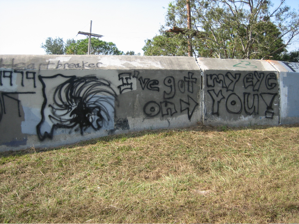
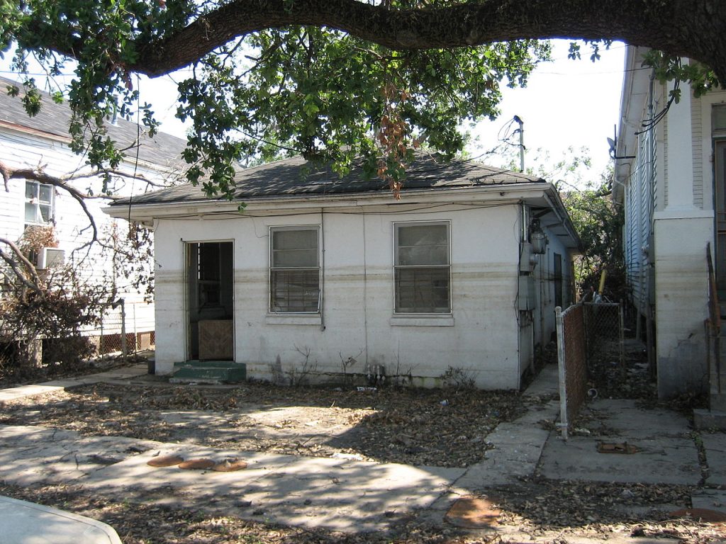
Louisiana, particularly New Orleans and the surrounding areas, relies heavily on an extensive levee system to protect communities from floodwaters. During Hurricane Katrina in 2005, levee failures resulted in catastrophic flooding that left much of New Orleans underwater. While significant upgrades have been made since then, the levee system remains vulnerable to extreme weather events like Hurricane Francine.
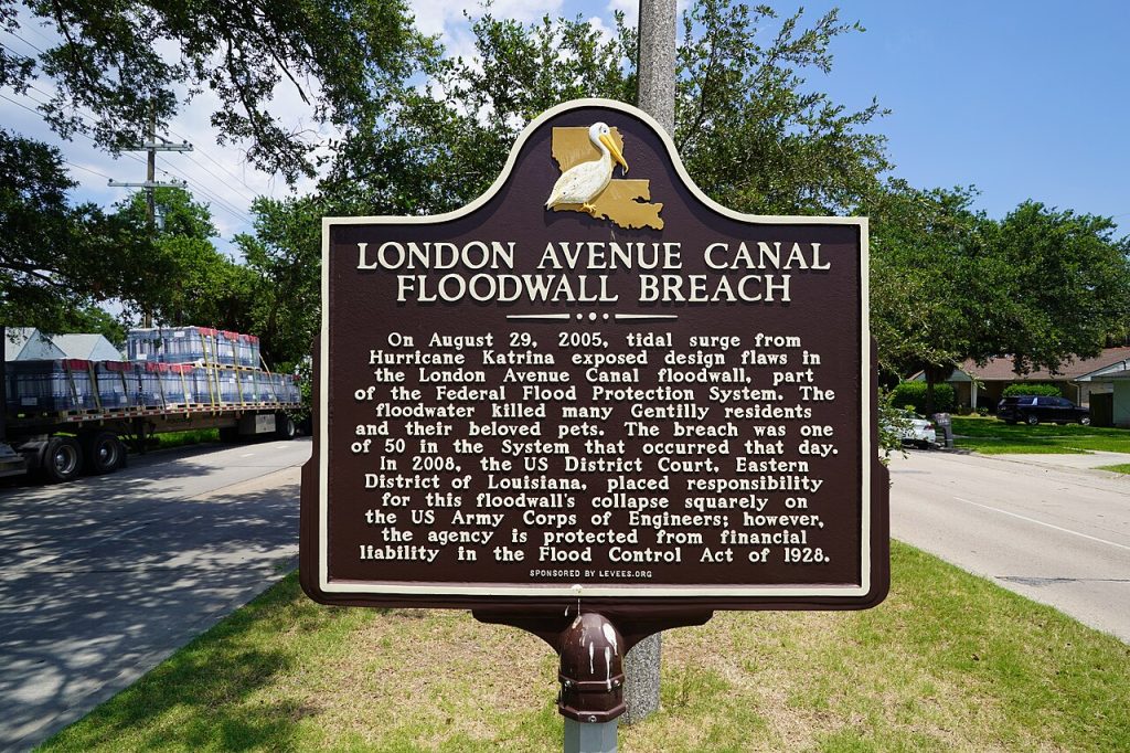
The storm surge generated by Francine is expected to put considerable pressure on the levee systems, particularly those near New Orleans and other low-lying areas along the coast. Heavy rainfall, combined with the storm surge, can lead to overtopping or even breaches in some levees, potentially causing widespread flooding.
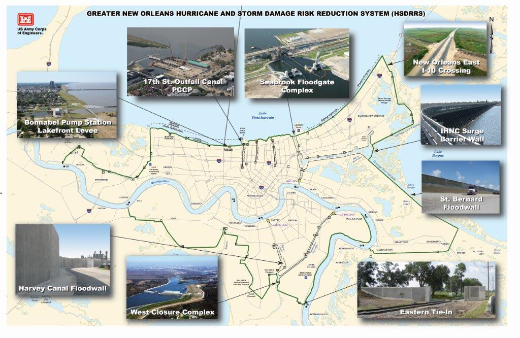
Since Hurricane Katrina, the U.S. Army Corps of Engineers has been involved in extensive efforts to improve flood defenses in Louisiana. One of the most notable projects is the Hurricane and Storm Damage Risk Reduction System (HSDRRS), a $14.5 billion initiative that includes 350 miles of levees, floodwalls, and surge barriers. This system was designed to protect the Greater New Orleans area from a “100-year storm,” a storm with a 1% annual chance of occurring.
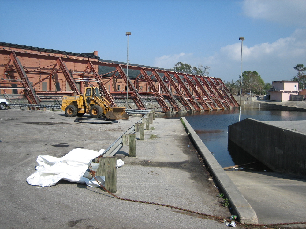
The Corps has also installed advanced pumps and floodgates designed to prevent water from overtopping levees and entering urban areas. In preparation for Hurricane Francine, the Army Corps of Engineers has deployed additional resources to monitor water levels, manage floodgates, and operate pumping stations. However, despite these efforts, there is no guarantee that the levees will hold under the potential intensity of Francine’s surge and rainfall.
In response to Francine, temporary barriers have been set up in areas vulnerable to flooding, and residents are urged to evacuate low-lying areas. The Corps has pre-positioned resources to respond quickly to any breaches or failures in the levee system, but the success of these defenses will largely depend on the intensity and track of the storm as it approaches land.
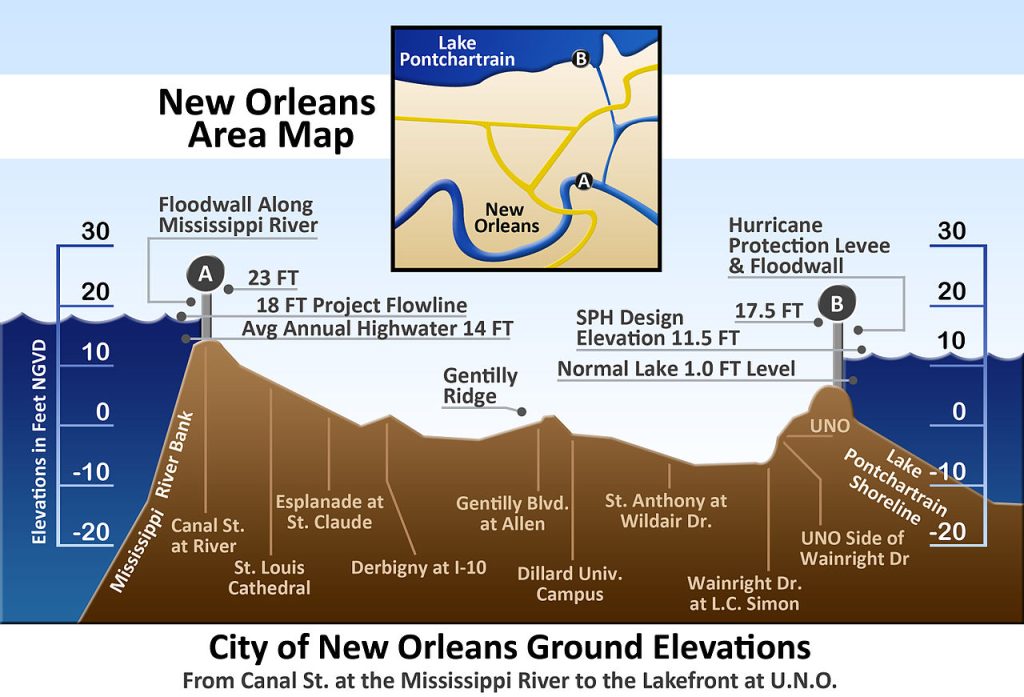
With Hurricane Francine expected to strengthen further before making landfall, the next 24-48 hours will be critical for Louisiana’s flood defenses. The levee systems, improved since Katrina, are about to face their biggest test in years. The combination of storm surge, heavy rainfall, and possible levee overtopping or breaches means that the region could still face widespread flooding, despite the extensive improvements.
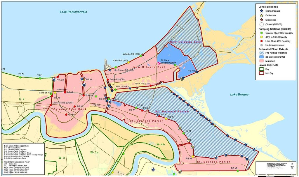
The Army Corps of Engineers will continue to monitor the situation and deploy resources as needed, but residents are encouraged to heed evacuation orders and prepare for potential flooding in vulnerable areas. Francine’s impact will not only serve as a test of Louisiana’s flood protection measures but also highlight areas where additional resilience is needed as climate change continues to drive more intense storms.

