
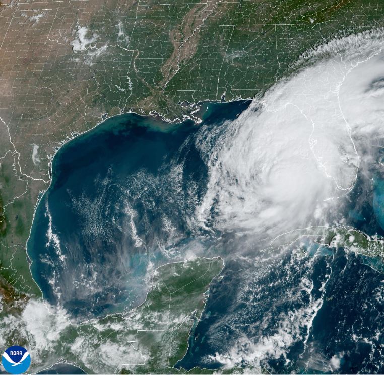
Hurricane Milton’s structure has started to change due to the onset of strong southwesterly shear, which the University of Wisconsin’s Cooperative Institute for Meteorological Satellite Studies (UW-CIMSS) is analyzing to be between 30 and 35 knots. The cloud canopy has become more asymmetric, with dry air infiltrating the western side of the circulation.
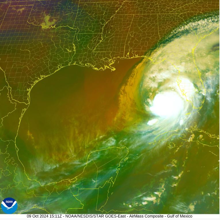
The eye of the storm has also become cloud-filled. NOAA and Air Force Reserve Hurricane Hunters have reported that the eye is open to the south, and recent dropsonde data shows the minimum pressure has increased to 931 millibars. Milton’s intensity is now set at 125 knots.
Deep-layer shear is expected to increase further today and into the evening, leading to continued weakening. However, with only about 12 hours left over water, Milton is expected to remain a major hurricane when it makes landfall tonight. Current forecasts suggest that Milton will be at category 3 or 4 strength when it reaches the coast. After landfall, a slow decrease in wind speeds is expected, but the storm is still predicted to move off the east coast of Florida on Thursday as a hurricane.
As Milton begins to interact with a front later this evening, the wind field is expected to expand on the storm’s northwestern side, which will likely result in very strong gusty winds to the north of its landfall location.
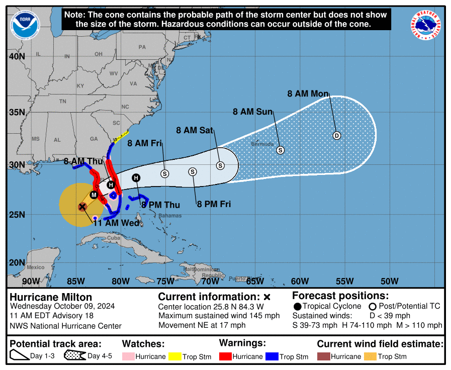
Milton is currently moving northeast at 15 knots. The models predict that it will continue on this path, but with a slower speed throughout today, followed by a turn to the east-northeast overnight. Forecasts remain close to previous predictions, though the exact landfall location remains difficult to predict due to the potential for the hurricane to wobble.
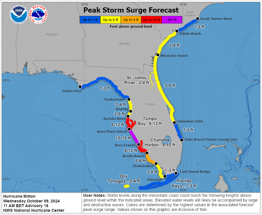
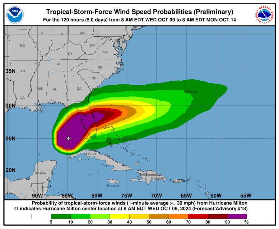
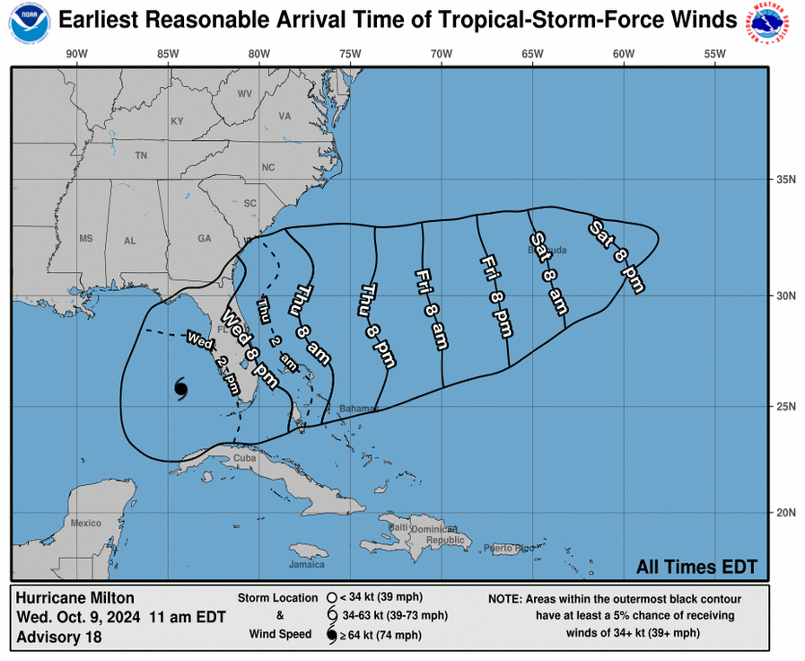
Even at 12-24 hours out, forecast tracks can be off by an average of 20-30 nautical miles. This means that storm surge forecasts, particularly around the Tampa Bay area and farther south, could vary widely depending on where the center of the storm comes ashore. However, the risk of devastating storm surge remains high due to the storm’s size and intensity.
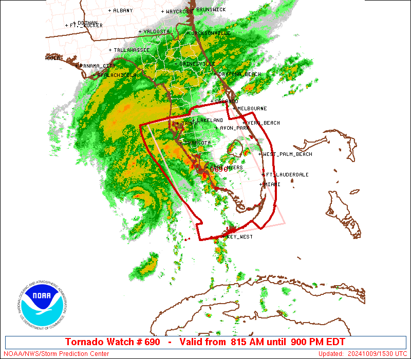
Finally, tornados, damaging winds, life-threatening storm surge, and heavy rainfall are expected to extend well beyond the forecast cone. This is a very serious situation, and residents in Florida are urged to follow instructions from their local emergency management officials. Evacuations and preparations should be completed as soon as possible.