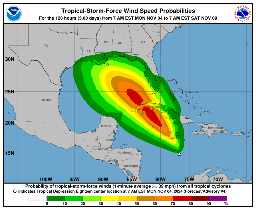
Tropical Depression Eighteen, expected to intensify into Hurricane Rafael, is steadily strengthening in the southern and central Caribbean Sea. Data from the Air Force Hurricane Hunters, satellite imagery, and surface observations confirm that the system has a well-defined center and organized convection, meeting the requirements for a tropical depression. As of now, maximum wind speeds are near 30 knots, with deep convection forming around the center and along the southern and eastern bands.
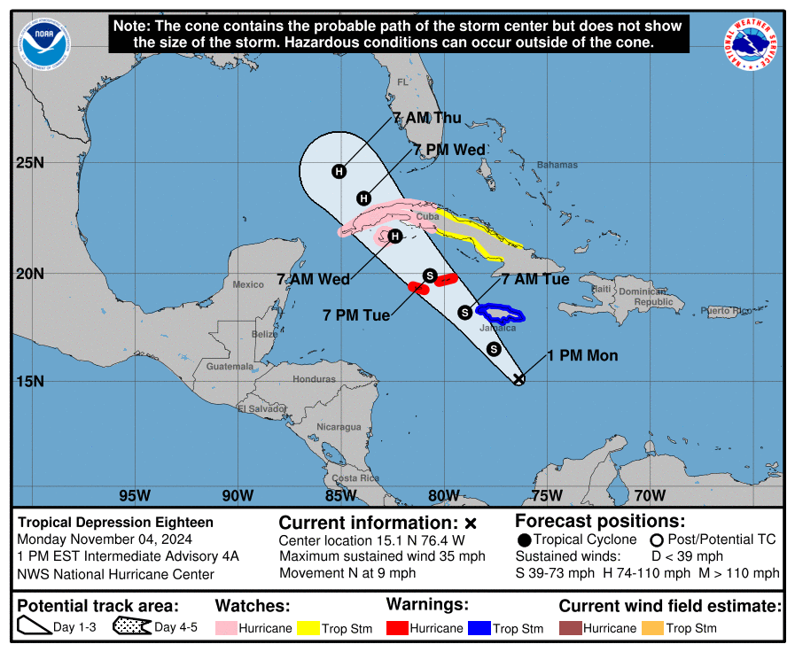
The system has shifted slightly northeast and is forecast to take a northwest turn later today. This path will bring it near Jamaica tonight, over the Cayman Islands by Tuesday night, and toward western Cuba by Wednesday. After that, the storm is projected to enter the Gulf of Mexico, but forecast models diverge, creating some uncertainty about its trajectory. Environmental conditions, including warm waters, low wind shear, and high atmospheric moisture, make it highly likely that the depression will intensify into Hurricane Rafael before reaching Cuba.
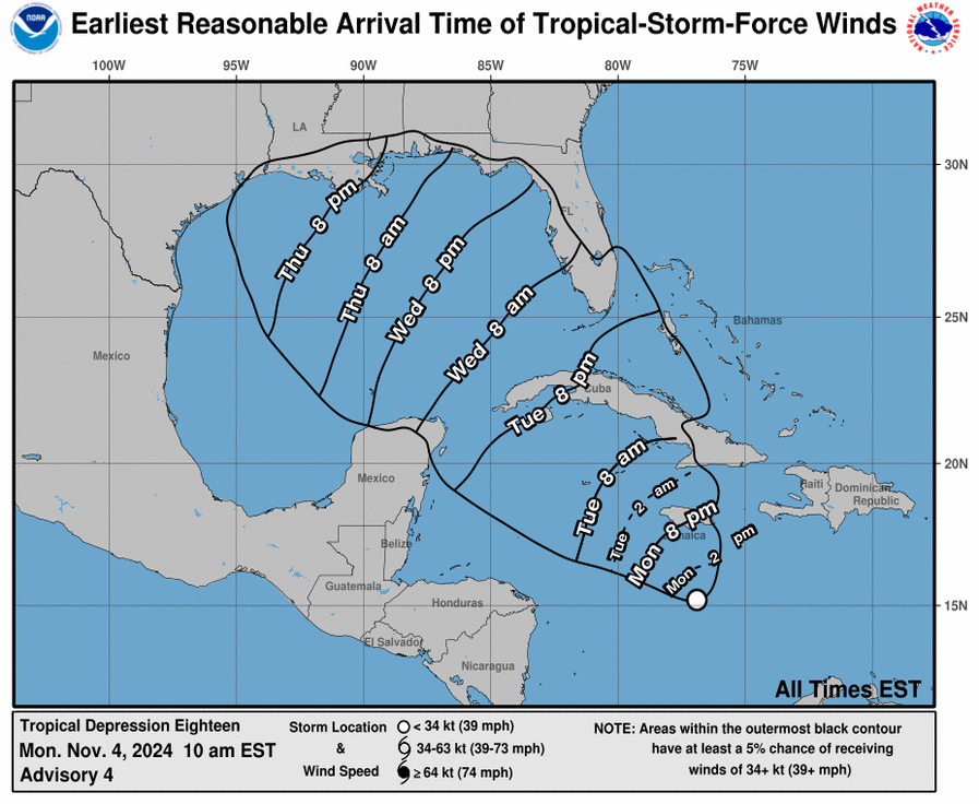
Florida, particularly the Keys and parts of South Florida, should remain vigilant, as the system’s path could bring tropical storm or hurricane conditions to the region. Watches and warnings may be issued later today for portions of the Florida Keys, with storm conditions potentially impacting the area mid to late week. Rafael’s track into the Gulf could bring heavy rain and strong winds to parts of Florida, depending on its exact course and intensity, which remain uncertain.
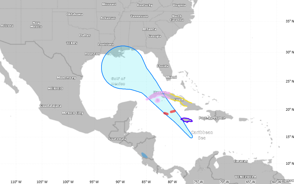
The storm is expected to bring significant rainfall across Jamaica, Cuba, and the western Caribbean, posing risks of flooding and landslides. As Rafael advances northward, Florida and nearby areas in the southeastern United States may also experience heavy rainfall and localized flooding later in the week, especially if the storm tracks closer to the state.
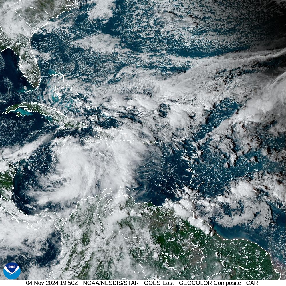
As the depression intensifies, it’s expected to become Hurricane Rafael, warranting close monitoring by residents along its projected path, particularly in Florida and surrounding Gulf areas. Regular updates from the National Hurricane Center and local meteorological services will be essential for tracking this evolving storm and any potential impacts on Florida.

