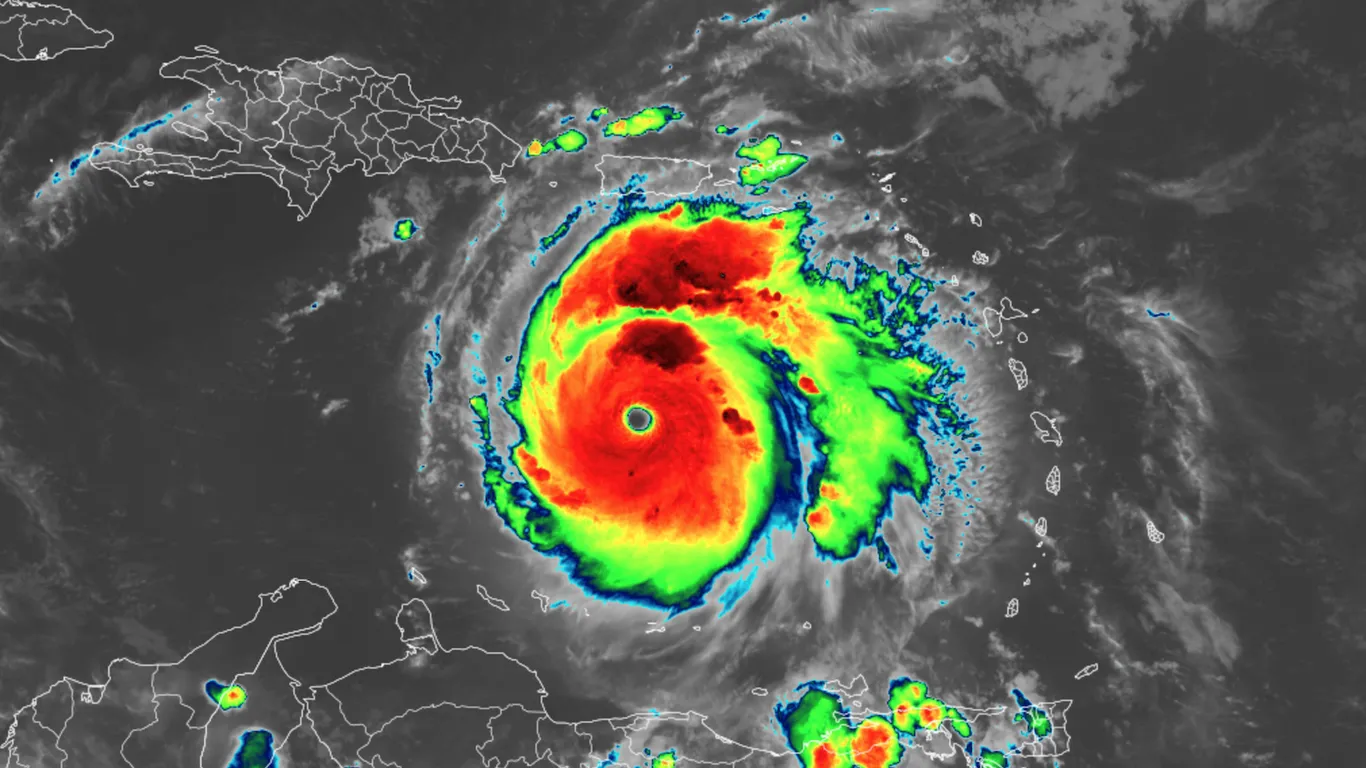
Hurricane Beryl, a storm of unprecedented ferocity, has left an indelible mark on the Caribbean and the southeastern United States. This 11-day tempest shattered multiple records, from becoming the earliest Category 4 and Category 5 storm to producing the most tornado warnings in a single July day. As the world grapples with the increasing frequency and intensity of such storms, Beryl may serve as a wake-up call for climate change skeptics.
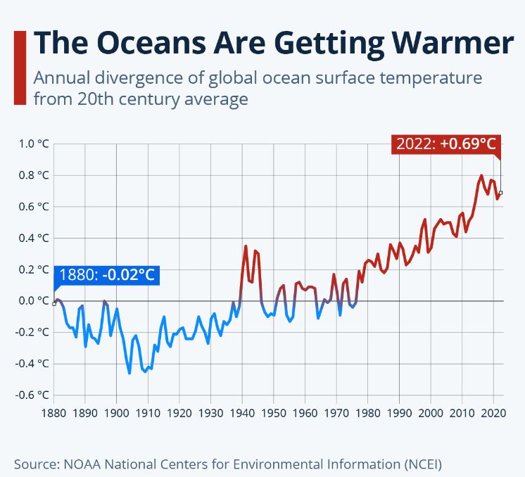
Beryl’s journey across the Caribbean Sea was marked by rapid intensification, driven by record-high ocean temperatures. This phenomenon, where a storm significantly strengthens in a short period, is becoming more common as global temperatures rise.
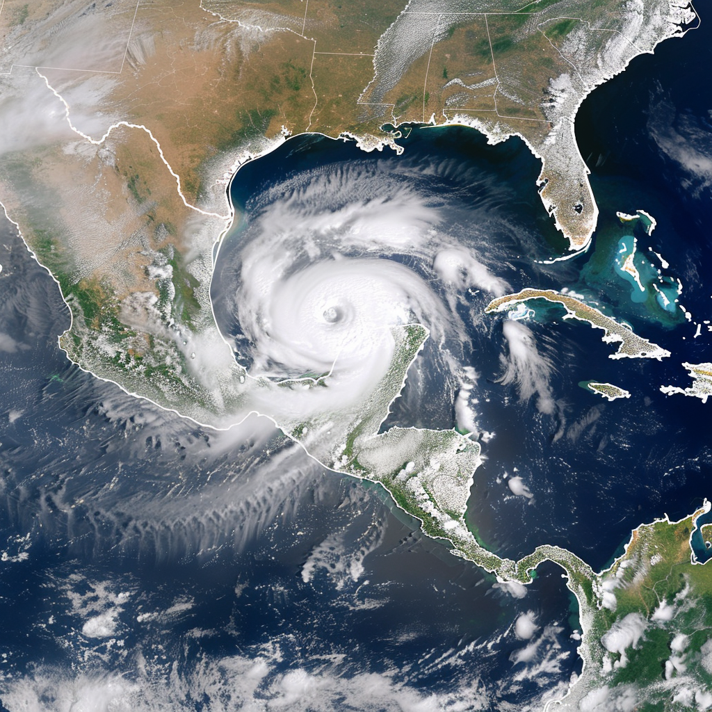
Beryl’s transformation from a tropical depression to a Category 5 hurricane stunned experts and underscored the impact of warmer seas on storm behavior. On July 1, Beryl made its first landfall as a Category 4 hurricane on Grenada’s Carriacou Island. Days later, it struck Mexico’s Yucatan Peninsula, leaving a trail of destruction and claiming at least 14 lives. Even after weakening, Beryl continued to break records as it moved inland, causing an unprecedented tornado outbreak in Texas, Louisiana, and Arkansas.
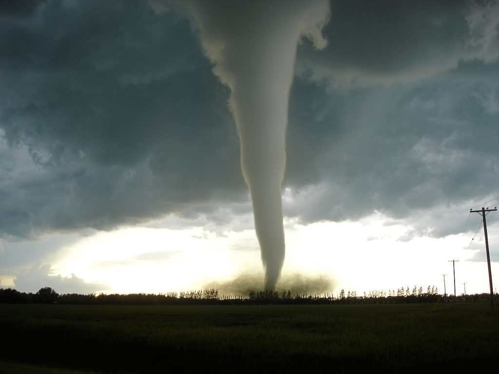
The storm generated 110 tornado warnings across three states on a single day, shattering the previous record of 67 warnings set in 1986. This level of tornado activity linked to a tropical cyclone is rare and demonstrates the storm’s extraordinary power.
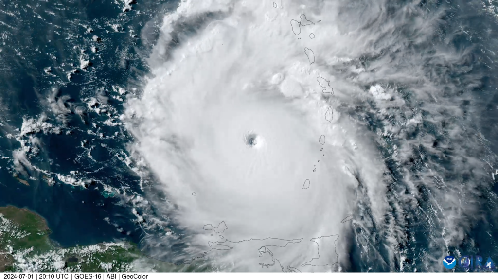
Beryl’s rapid intensification and early formation broke several long-standing records. It became the earliest Category 4 hurricane on July 1, surpassing Hurricane Dennis (2005). It also became the earliest Category 5 hurricane, breaking the record set by Hurricane Emily (2005) by over two weeks. Beryl nearly became the earliest major hurricane (Category 3 or higher) in the Atlantic, with only Hurricane Alma (1966) and Hurricane Audrey (1957) occurring earlier in the season. Furthermore, Beryl set a new record for forming east of the Lesser Antilles, previously held by Hurricane Audrey.
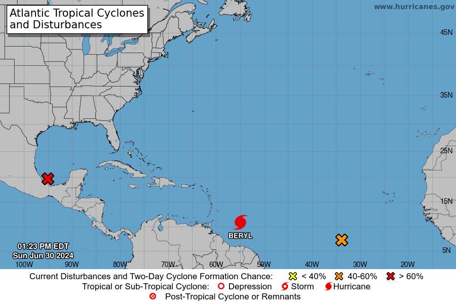
Forming at 49.3°W, Beryl became the easternmost hurricane to form in the tropical Atlantic in June, beating a record set in 1933. Beryl reached wind speeds of 165 mph, surpassing Hurricane Audrey’s (1957) 125 mph in June and Hurricane Emily’s (2005) 165 mph in July. Beryl’s wind speeds increased by 65 mph within 24 hours, making it one of the few storms to undergo such rapid intensification early in the hurricane season. Beryl remained a major hurricane for 4.5 days, surpassing Hurricane Emily’s record of 4.25 days.
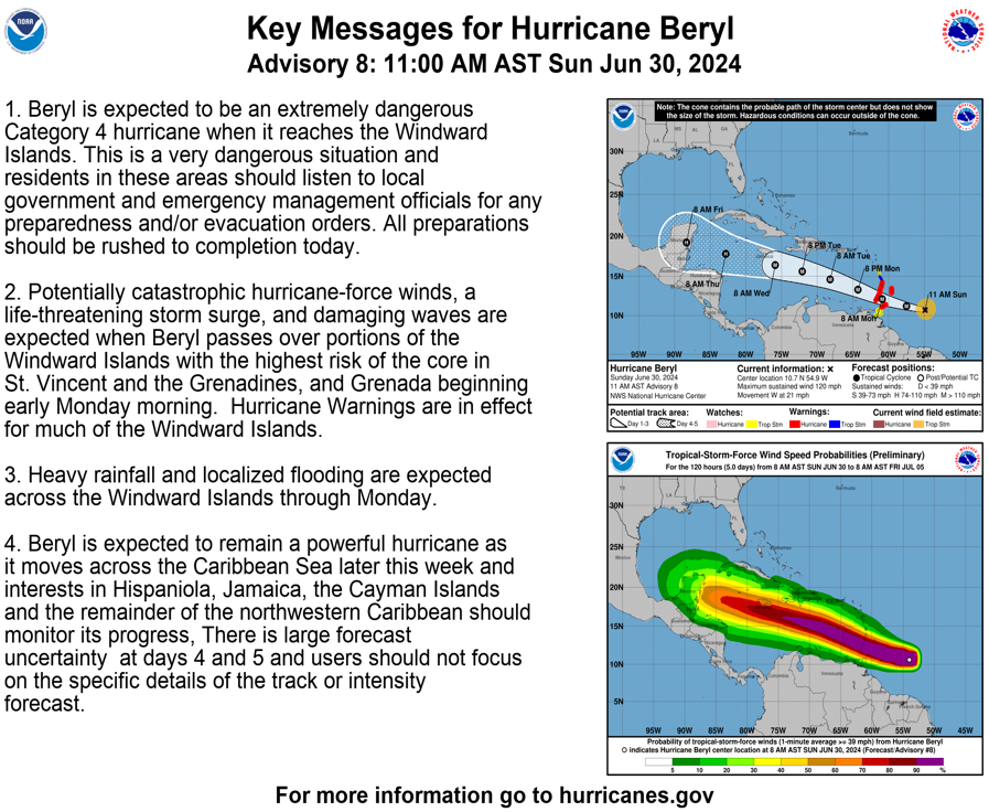
Hurricane Beryl’s extraordinary characteristics provide a stark illustration of the increasing power of tropical storms in a warming world. The correlation between rising sea temperatures and the intensification of hurricanes is well-documented, yet often dismissed by climate change deniers. Beryl’s unprecedented behavior serves as a potent reminder of the urgency to address climate change.

The cognitive dissonance experienced by climate change deniers is profound. They witness the undeniable evidence of stronger, more frequent storms yet cling to outdated beliefs that deny the role of human activity in global warming. The sheer number of records broken by Beryl, from early formation to tornado outbreaks, underscores the shifting nature of our climate. For skeptics, the data is irrefutable: warmer oceans fuel stronger and more unpredictable storms. As we continue to witness the devastating effects of climate change, it is imperative to acknowledge the reality of these changes and take decisive action to mitigate their impact.
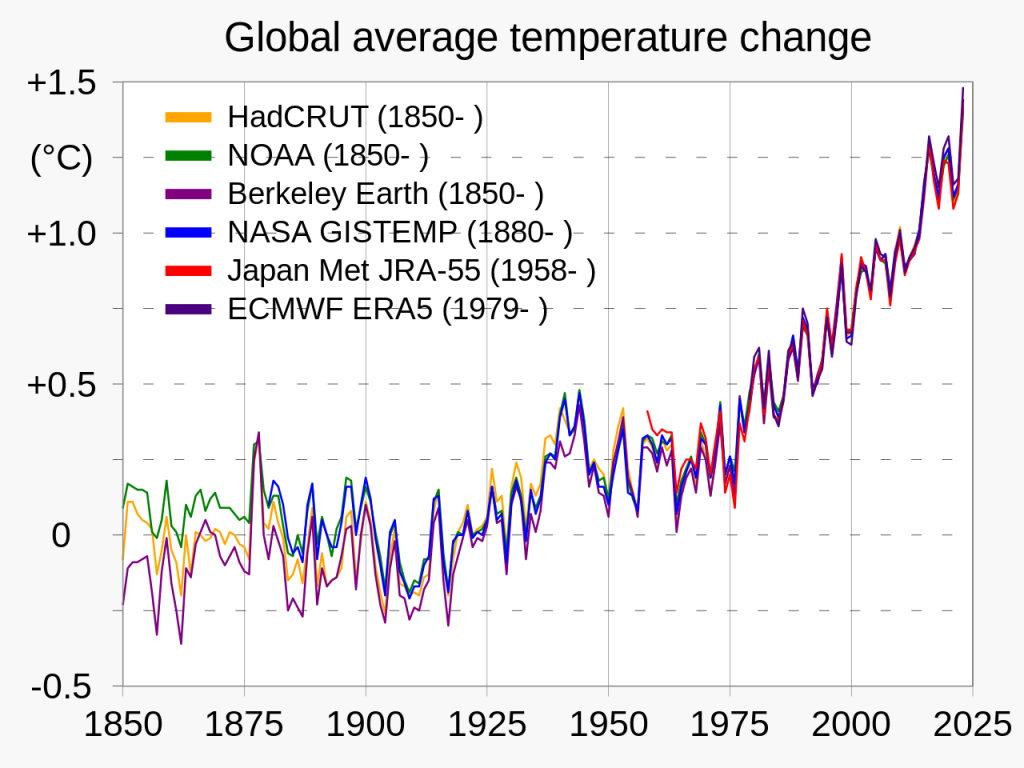
Hurricane Beryl’s historic rampage across the Caribbean and southeastern United States is a clarion call to those who deny the reality of climate change. The storm’s unprecedented intensity and record-breaking nature highlight the urgent need for global cooperation and action to address the underlying causes of our warming planet. Ignoring the signs will only lead to more catastrophic storms in the future, threatening lives and livelihoods across the globe.

