
As of late Monday, September 23, 2024, Potential Tropical Cyclone Nine is showing little change in organization, but if it strengthens into a hurricane, it will be named Hurricane Helene. According to the National Hurricane Center, the system lacks a well-defined center of circulation but continues to produce strong convection on its eastern side. Current advisory estimates hold the system’s intensity at 30 knots, and an Air Force reconnaissance mission is scheduled to provide more detailed information on the storm’s structure and strength.
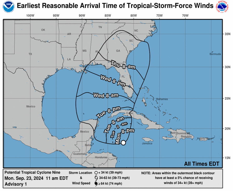
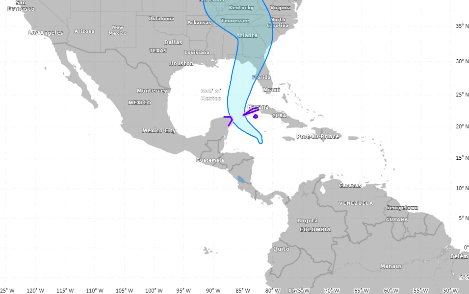
The system is currently moving north-northwest at a slow pace of 5 knots. Forecasters expect it to shift northwestward in the coming day as it moves along the southern and southwestern side of a mid-level high-pressure area. As the high moves east and a mid-level trough forms over the central United States, Helene is projected to accelerate toward the northeastern Gulf Coast, potentially reaching the Florida Panhandle and western Florida coast by Thursday. Track models show strong agreement, indicating that the Gulf Coast, particularly Florida, could face significant impacts.
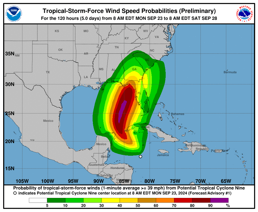
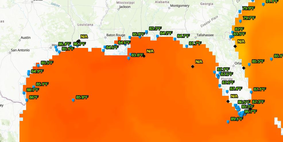
Although upper-level wind shear is currently disrupting the system, conditions are expected to become more favorable for intensification. Helene will move over waters with very high ocean heat content, which will promote rapid strengthening. Noaa Forecasters predict that the system will become a major hurricane before it reaches the Gulf Coast. Despite some expected weakening after landfall, Helene is likely to hit the coast as a major hurricane. The storm is also expected to increase in size, spreading its impacts far from the center.
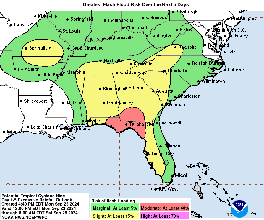
As the storm approaches western Cuba and the northeastern Yucatan Peninsula, tropical storm conditions are expected, with hurricane-force winds possible by Tuesday night. The Florida Panhandle and the west coast of Florida could experience life-threatening storm surge and damaging winds by Thursday. Storm surge watches are likely to be issued on Tuesday as the storm’s track becomes clearer. Heavy rainfall will affect western Cuba, with the potential for flooding and mudslides. In Florida, flash and urban flooding risks are increasing, with potential flooding also extending into the Southeast and Tennessee Valley later in the week.
With the potential for Hurricane Helene to intensify and deliver widespread impacts, residents along the Gulf Coast are urged to prepare. As the storm develops, staying informed through official updates and advisories will be critical for those in its path. Helene’s impacts, including dangerous storm surges, heavy rain, and strong winds, could extend far inland, making it essential to follow preparedness plans in the days ahead.