
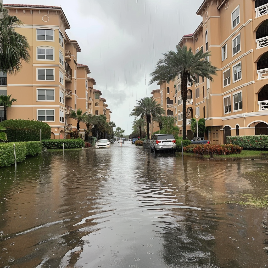
SARASOTA, FL – A city on Florida’s west coast experienced an unprecedented deluge of rain on Tuesday evening, marking a record-breaking event that underscores the growing intensity of weather patterns attributed to climate change. In just three hours, Sarasota was drenched with an astounding 8 inches of rain, leading to flash floods that disrupted traffic and delayed hundreds of flights across the state.
The heavy rainfall, occurring between 5 p.m. and 8 p.m., was so unusual that meteorologists estimate such an event should only occur once every 500 to 1,000 years. The Tampa Bay area, which typically expects 7.3 inches of rain for the entire month of June, saw nearly this amount in just a few hours, highlighting the severity of the storm.
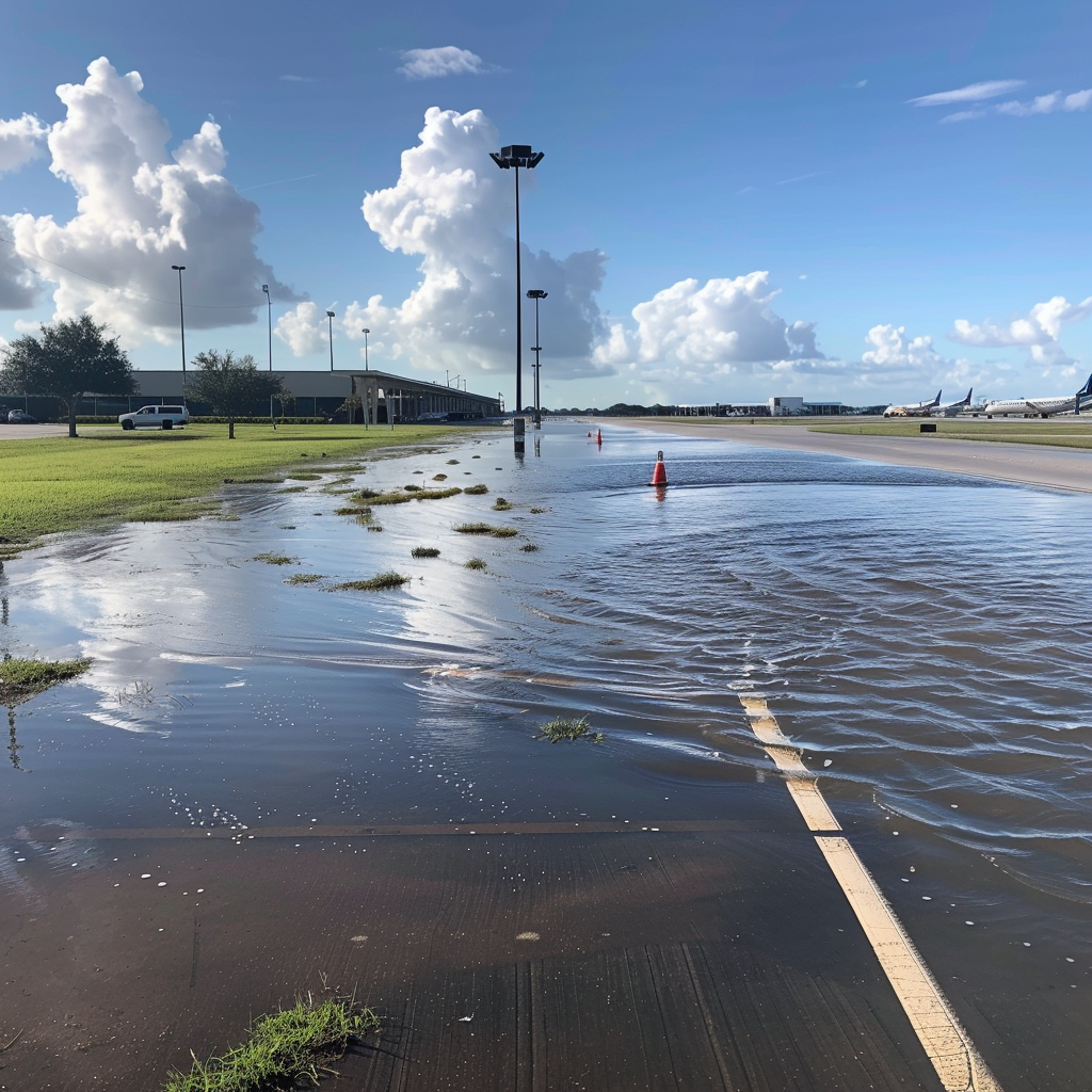
One of the most notable records was set at the Sarasota-Bradenton Airport, where 3.93 inches of rain fell in just one hour. Coastal areas in Sarasota County were particularly hard-hit, with some locations receiving up to 10 inches of rain on Tuesday alone. The National Weather Service (NWS) office in Tampa Bay warned that similar conditions could persist throughout the week.
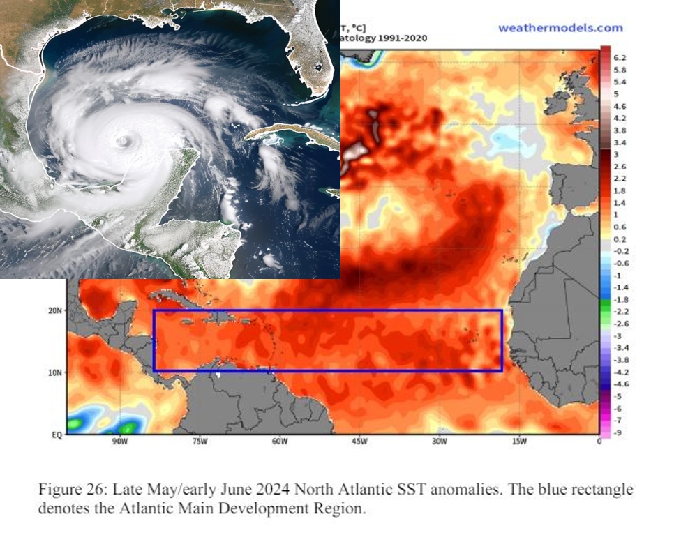
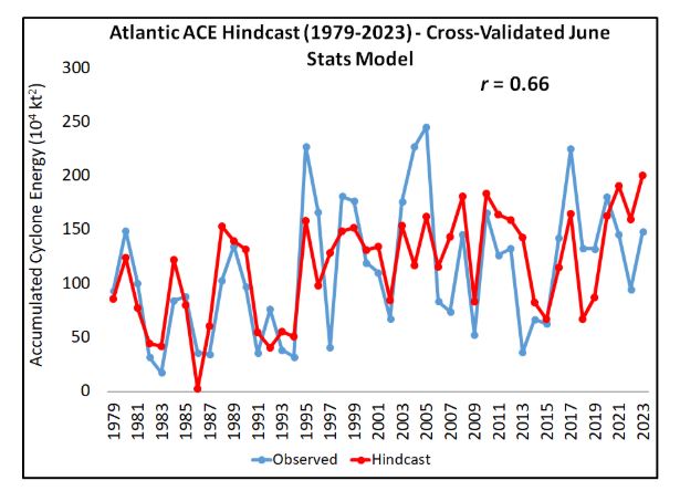
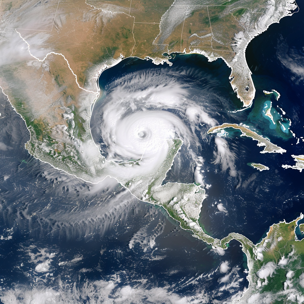
The extreme weather in Sarasota is a precursor to what experts predict will be an extremely active Atlantic hurricane season in 2024. According to an extended range forecast, conditions are ripe for a significant number of hurricanes, bolstered by anticipated La Niña conditions and record warm sea surface temperatures in the tropical Atlantic and Caribbean regions.
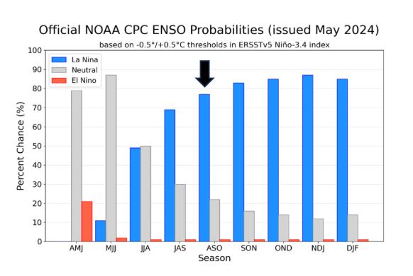
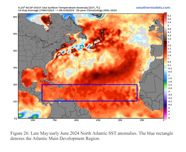
La Niña conditions, which reduce tropical Atlantic vertical wind shear, combined with unusually warm sea surface temperatures, create an ideal environment for hurricane formation and intensification. Current sea surface temperatures in the Main Development Region of the Atlantic are approximately 1.4°C above the 1991–2020 average, further supporting the likelihood of a hyperactive hurricane season.
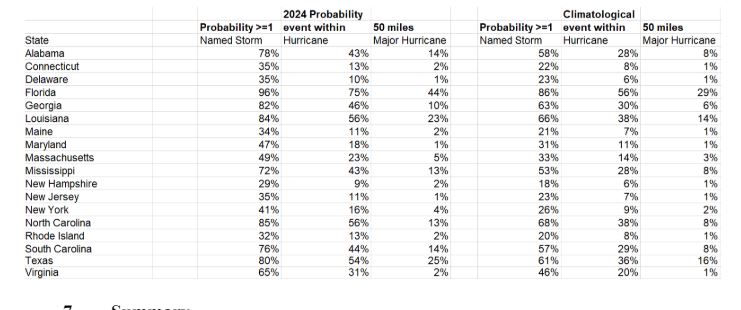
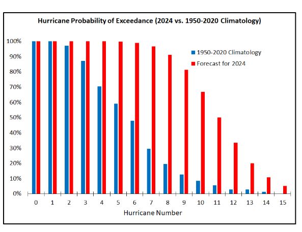
Experts predict the 2024 Atlantic hurricane season will feature 23 named storms, 11 hurricanes, and 5 major hurricanes. This forecast is well above the 1991–2020 average of 14.4 named storms and 7.2 hurricanes. The probability of a major hurricane making landfall along the U.S. coastline is significantly higher than historical averages, with a 62% chance for the entire U.S. coastline compared to the historical average of 43%.
Given these predictions, coastal residents are urged to prepare thoroughly for the hurricane season, regardless of the specific forecasts. The reminder that it only takes one hurricane making landfall to have a devastating impact emphasizes the importance of readiness and vigilance.
The record rainfall in Sarasota and the forecasted intense hurricane season are part of a broader trend of increasingly extreme weather events driven by climate change. Warmer sea temperatures and altered atmospheric conditions are making storms more powerful and precipitation events more severe, posing significant challenges for communities and emergency response systems.
The current conditions are reminiscent of past hyperactive seasons but are exacerbated by the ongoing warming trends. Historical data and predictive models both point to a future where such extreme weather events become more frequent and severe, underlining the urgent need for climate adaptation and mitigation strategies.
While Sarasota’s record rainfall is a localized event, it serves as a stark reminder of the broader impacts of climate change. Coastal communities worldwide face similar threats, and the need for robust infrastructure and comprehensive disaster preparedness plans is more critical than ever.
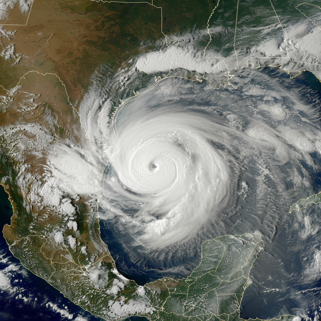
As US coastal cities braces for a potentially record-setting hurricane season, the unprecedented rainfall in Sarasota stands as a testament to the escalating impact of climate change on our weather systems. The state and its residents must remain vigilant and prepared for what could be a defining season of extreme weather events.