
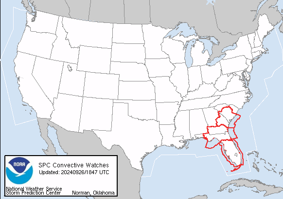
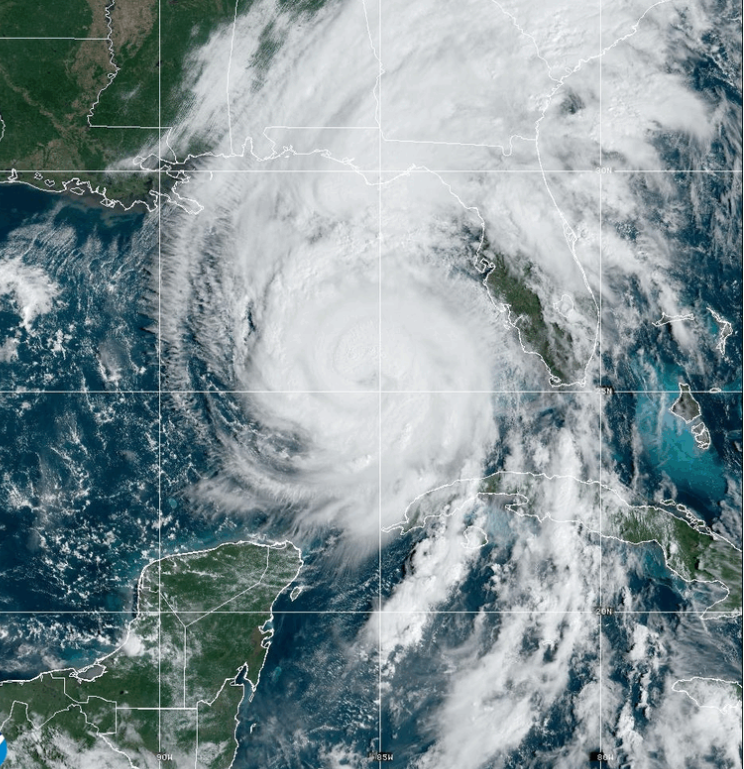
As Hurricane Helene strengthens and approaches the southeastern United States, the National Weather Service (NWS) has issued multiple tornado watches for parts of Florida, Georgia, and South Carolina. Powerful rainbands and increasing low-level wind fields have created conditions highly favorable for tornado development, putting millions of residents in these areas on alert.
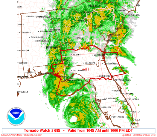
The NWS Storm Prediction Center issued Tornado Watch Number 685 at 10:45 AM EDT, covering northern Florida and southern Georgia, in effect until 10:00 PM EDT. Several tornadoes are likely as rainbands from Hurricane Helene continue to sweep through the area. Wind conditions are expected to worsen as the storm moves northward, with low-level winds becoming more favorable for tornado development. The affected area spans about 60 miles north and south of a line from Tallahassee, FL, to Gainesville, FL. Residents are advised to remain vigilant and monitor local weather alerts.
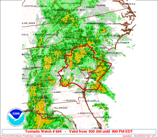
Earlier this morning, Tornado Watch Number 684 was issued at 8:30 AM EDT for parts of eastern Georgia and central and southern South Carolina. This watch remains in effect until 9:00 PM EDT. Several tornadoes are expected in the region as increasingly strong winds on the northeastern side of Hurricane Helene heighten the risk of tornado formation. The watch area extends roughly 70 miles east and west of a line from Savannah, GA, to Columbia, SC.
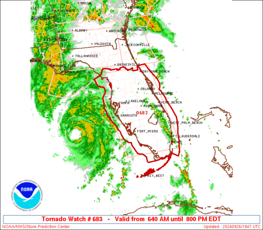
Tornado Watch Number 683, issued at 6:40 AM EDT, covers much of the Florida Peninsula and is in effect until 8:00 PM EDT. The Florida Peninsula is facing significant risks today as the combination of a moist atmosphere and strengthening low-level wind shear creates conditions conducive to tornadoes. The watch area runs approximately 85 miles east and west of a line from Ocala, FL, to Miami, FL.

A tornado watch means conditions are favorable for tornadoes to develop. Residents in the affected areas should stay tuned to local weather stations, have a plan in place, and be prepared to take shelter if a warning is issued. The NWS has also cautioned aviators about severe turbulence, surface wind gusts reaching 60 knots, and cumulonimbus clouds with tops as high as 50,000 feet. Pilots in the affected areas should exercise extreme caution.
As Hurricane Helene continues its northward path, the threat of tornadoes will persist throughout the day across the southeastern U.S. Residents are encouraged to remain alert, follow local advisories, and take necessary precautions to ensure their safety during this severe weather event.

For the latest updates and a complete depiction of the tornado watch areas, residents should refer to official NWS updates and local emergency services.