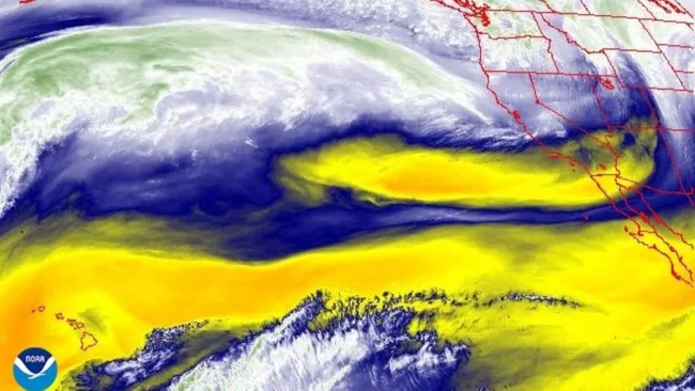
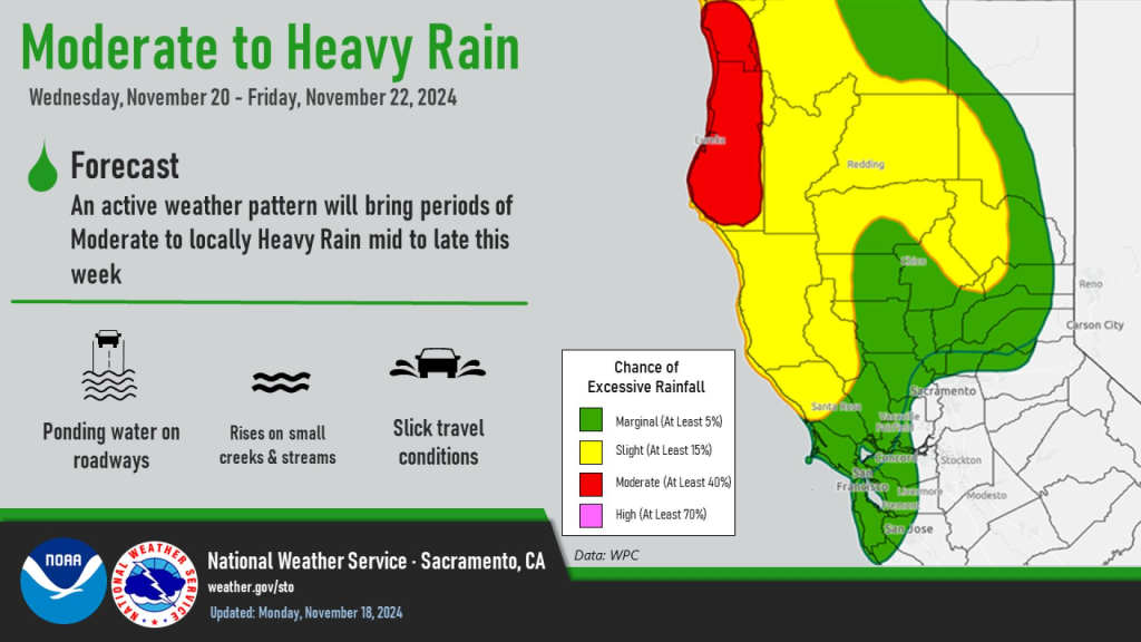
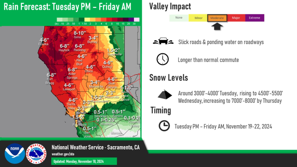
The National Weather Service has issued a Flood Watch for the Northern and Central Sacramento Valley, Mountains Southwestern Shasta County to Western Colusa County, the Northeast Foothills, and the Shasta Lake Area, effective from Tuesday night through early Saturday morning. This prolonged weather event, driven by an approaching atmospheric river, is expected to bring 3 to 6 inches of rain, with up to 8 inches possible in the foothills. The heavy rainfall could lead to significant flooding, raising river levels sharply and causing dangerous water accumulation on roads and in low-lying areas. Residents are urged to stay informed and prepare for potential flood conditions.
This atmospheric river comes amid concerns that California may again face the kind of catastrophic flooding that transformed the Sacramento Valley in 1861-1862. That winter, relentless storms inundated central California for 43 days straight. The Sierra Nevada rivers swelled into torrents, sweeping entire communities and livestock into a watery abyss. The Central Valley, which serves as the state’s agricultural heartland, became a vast inland sea stretching 300 miles long and 20 miles wide. Sacramento, the state capital, was submerged under 10 feet of muddy water, filled with debris from nearby landslides.
The consequences were devastating. Thousands of lives were lost, and one-quarter of California’s cattle drowned. With the state legislature forced to relocate to San Francisco and the economy in ruins, California faced financial ruin. Experts now warn that a similar event could occur in modern times, driven by a mega storm or successive atmospheric river systems. Thankfully this system is predicted to only last 3 days instead of 43.

Climatologists have studied sediment records to learn more about California’s history of flooding. Evidence from floodplains, marshes, and lake beds indicates that such massive floods have struck every 200 years or so. Source: Here If the timeline holds, California could be due for another disaster, as more than 160 years have passed since the last mega flood. The intense rain and runoff from the upcoming atmospheric river could serve as good reminder of the state’s vulnerability. If you live in the region flood insurance might be a good idea.
While atmospheric rivers are crucial for the region’s water supply—contributing between 30% to 50% of annual precipitation—they can also be deadly. The approaching storm is expected to bring extreme conditions, including wind gusts of up to 70 mph, heavy rainfall rates of 2 to 4 inches per day, and significant snow accumulation in the mountains. The rapid intensification of the storm system, classified as a “bomb cyclone,” highlights the ferocity of these weather patterns in an every changing climate.
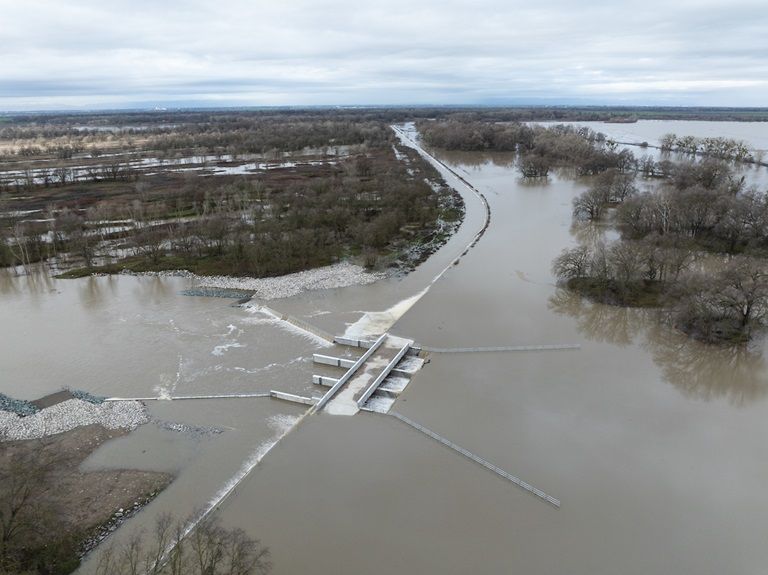
A photo of Fremont Weir along the Sacramento River overtopping in California from the last major atmospheric river to hit the region in February 2024. Despite modern flood control measures, much of California’s infrastructure remains at risk. The Sacramento Valley, in particular, has seen extensive development on floodplains that were underwater in 1862. As scientists and emergency planners emphasize the importance of preparedness, the history of California’s past floods serves as a sobering lesson. The hope is that the knowledge gained from past disasters, coupled with today’s advanced forecasting, can prevent a repeat of the catastrophic flooding that once paralyzed the state.

