
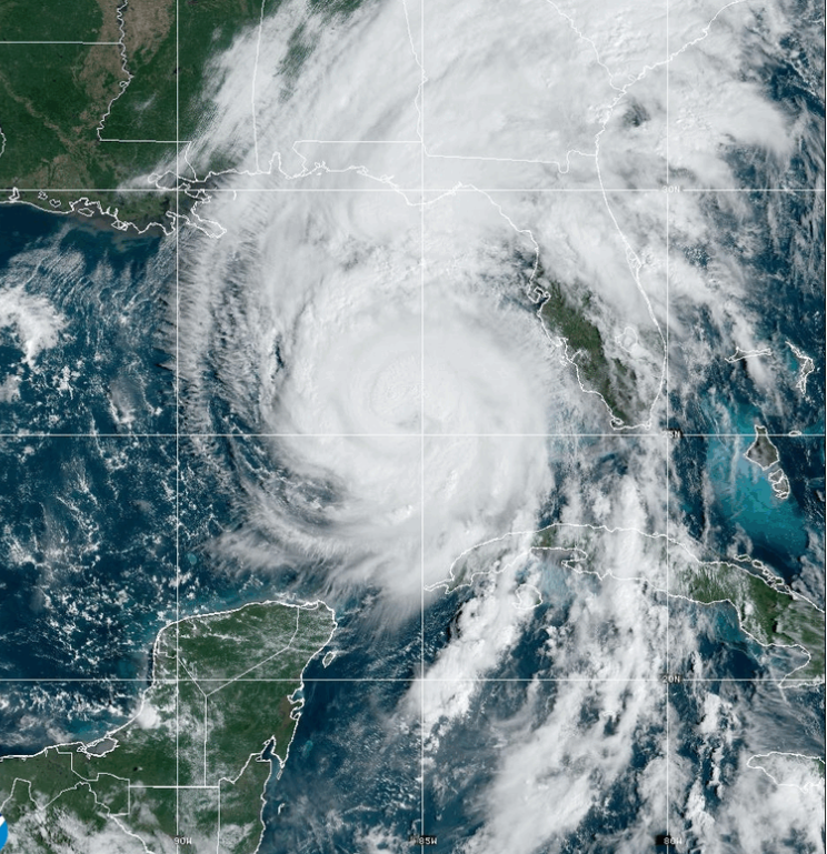
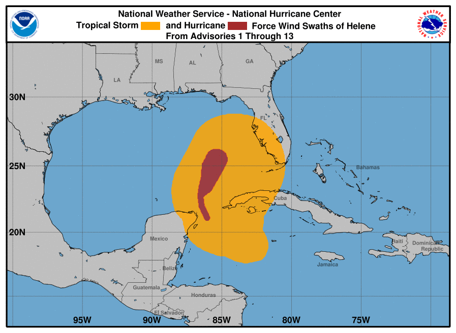
Hurricane Helene is intensifying as it moves closer to the Florida Big Bend, with landfall expected later this evening. The National Hurricane Center has reported that Helene now has sustained winds of 90 knots, or approximately 104 mph, and could further strengthen to a Category 4 hurricane before it reaches the coast. Satellite imagery shows a large, well-formed eye and convective banding around the storm, while data from NOAA and Air Force Hurricane Hunter aircraft confirm the eyewall is nearly closed and the central pressure has dropped to 960 mb. Tropical-storm-force winds have already been recorded in parts of South Florida and the Florida Keys, and conditions are expected to worsen rapidly throughout the day.
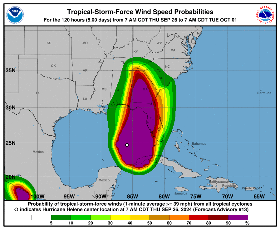
Helene is moving north-northeast at 12 knots and is forecasted to pick up speed as it approaches the Florida coast. Once inland, the storm will track over Georgia and eventually slow down or stall over the Tennessee Valley as it merges with a mid- to upper-level low-pressure system. Although the projected path remains largely unchanged, Helene’s massive size means that areas far from the storm’s center will experience severe conditions. The east side of the storm, in particular, is expected to see dangerous storm surges, heavy winds, and torrential rainfall.
As the hurricane moves over warm waters with conducive atmospheric conditions, further strengthening is likely before it makes landfall. While some models suggest it could reach Category 4 status, all forecasts agree that Helene will strike as a major hurricane. Residents in the affected areas are urged to complete their preparations quickly, as conditions will deteriorate rapidly.
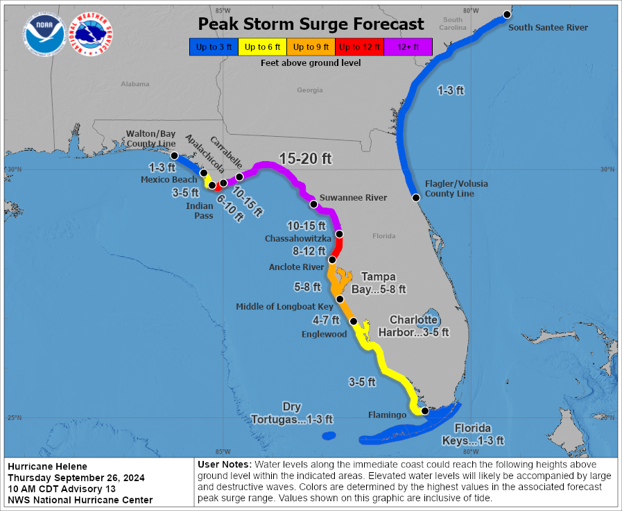
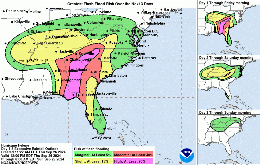
Hurricane Helene poses a range of serious threats. A catastrophic storm surge is expected along the Florida Big Bend, with water levels possibly rising up to 20 feet above ground level, along with destructive waves. Other areas along Florida’s west coast also face life-threatening storm surges. Hurricane-force winds near the eyewall will bring significant damage, extending well inland to northern Florida and southern Georgia later tonight. Even further north, strong wind gusts are likely to affect areas in northern Georgia and the southern Appalachians. Catastrophic flash and urban flooding, along with landslides, are expected across the southern Appalachians through Friday, while significant river flooding is likely throughout the Southeast.
Residents in evacuation zones and along the storm’s projected path are strongly encouraged to follow local evacuation orders and take all necessary precautions to protect life and property. With Helene set to make landfall as a powerful and large hurricane, the impacts will be widespread and severe.